Cherkley Court, Reigate Road, Leatherhead
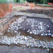
Archaeological monitoring by J Payne of SCAU during limited pipeline repair works within the Scheduled Monument area of the Roman road Stane Street. The previously recorded dimensions and make-up of the Roman road (SyAC 75, 289) were confirmed while the presence of a possible levelling deposit associated with the initial construction of the road, and not previously recorded, was also revealed.